Our Technology

Advanced UAV platforms and imaging systems that deliver research-grade data for real-world applications.

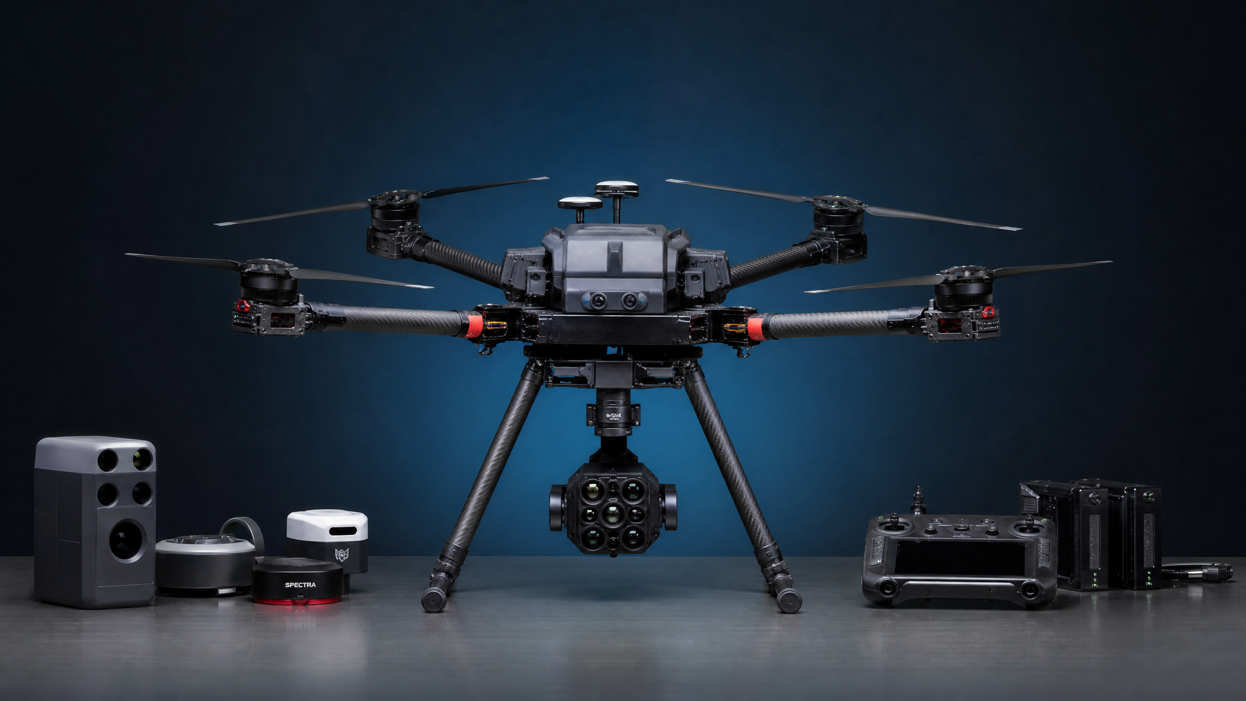
AerialPhotonics UAV and sensor equipment

Professional-Grade UAV Systems

AerialPhotonics operates advanced commercial UAV platforms specifically selected for mapping and inspection applications. Our aircraft are equipped with precision RTK/PPK GPS systems for centimeter-level positional accuracy without the need for extensive ground control networks.

Every flight is conducted by FAA Part 107 certified remote pilots with extensive experience in complex airspace environments, including Class B, C, and D airspace surrounding San Diego International Airport and other regional airports.

✈️
FAA Part 107 Certified Licensed commercial drone operations
πŸ“‘
RTK/PPK GPS Centimeter-level positional accuracy
πŸ›‘οΈ
Fully Insured Commercial liability coverage
πŸ—ΊοΈ
Airspace Authorized LAANC and waiver capable

Advanced Sensor Payloads

Our sensor suite captures the full spectrum of data needed for comprehensive vegetation and terrain analysis.

🌈

Multispectral Camera

5-band multispectral sensor capturing Blue (475nm), Green (560nm), Red (668nm), Red Edge (717nm), and Near-Infrared (840nm) bands simultaneously. Includes downwelling light sensor for radiometric calibration.

πŸ“·

High-Resolution RGB

Full-frame 45MP RGB camera delivering ultra-sharp orthomosaics with ground sample distances as fine as 1–2 cm. Ideal for detailed visual inspection and photogrammetric mapping.

🌑️

Thermal Infrared

Radiometric thermal camera for temperature mapping applications including irrigation leak detection, heat stress analysis, and infrastructure inspection.

πŸ“‘

RTK GNSS System

Real-Time Kinematic GPS positioning system providing centimeter-level accuracy for all mapping products, eliminating or minimizing the need for ground control points.

πŸ’»

Photogrammetry Processing

Industry-leading photogrammetry software processes raw imagery into orthomosaics, DEMs, point clouds, and 3D models. Outputs are compatible with ArcGIS, QGIS, AutoCAD, and all major GIS platforms.

☁️

Cloud Delivery Platform

Secure online delivery of all data products. Clients can access interactive maps, 3D models, and downloadable files through a password-protected project portal.

Understanding Multispectral Imaging

Plants interact with light in ways invisible to the human eye. Our sensors capture these interactions to reveal health and stress.

🌿

NDVI

Normalized Difference Vegetation Index β€” The most widely used vegetation index. Healthy plants absorb red light and reflect near-infrared; NDVI measures this ratio to quantify photosynthetic activity and biomass.

Low ← NDVI Value β†’ High

πŸ”΄

NDRE

Normalized Difference Red Edge β€” More sensitive than NDVI for detecting early-stage stress and nitrogen deficiency in dense canopy. Particularly effective for tree canopy and precision agriculture applications.

Stressed ← NDRE Value β†’ Healthy

πŸ’§

CWSI

Crop Water Stress Index β€” Measures plant water status by analyzing canopy temperature relative to air temperature. Identifies irrigation deficiencies and water stress before visible wilting occurs.

Well-Watered ← CWSI β†’ Stressed

Certified, Insured & Compliant

Every flight we conduct meets or exceeds FAA regulations and industry safety standards.

✈️

FAA Part 107

All pilots hold current FAA Part 107 Remote Pilot Certificates, the federal requirement for commercial drone operations.

πŸ›‘οΈ

Liability Insurance

We carry comprehensive commercial liability insurance to protect our clients and their properties on every project.

πŸ“‹

LAANC Authorized

We operate within the FAA's Low Altitude Authorization and Notification Capability system for controlled airspace operations.

πŸ”’

Data Security

All client data is stored securely and delivered via encrypted channels. We maintain strict data privacy protocols.

Ready to Harness the Power of Aerial Intelligence?

Contact us to discuss how our technology can address your specific project requirements.

Request a Consultation